Derrick Burt's GIS Portfolio
A collection of GIS analyses and maps.
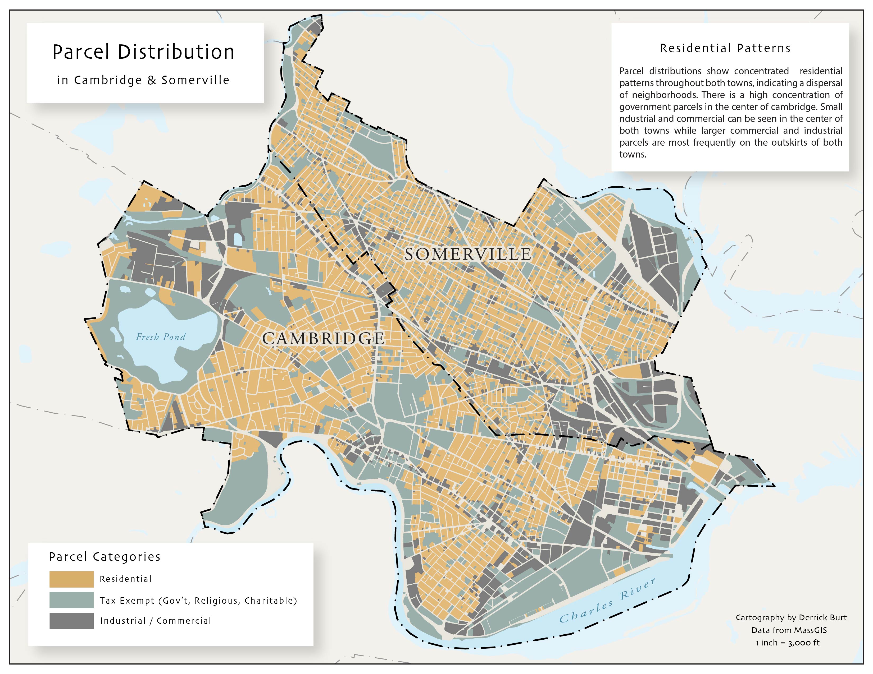
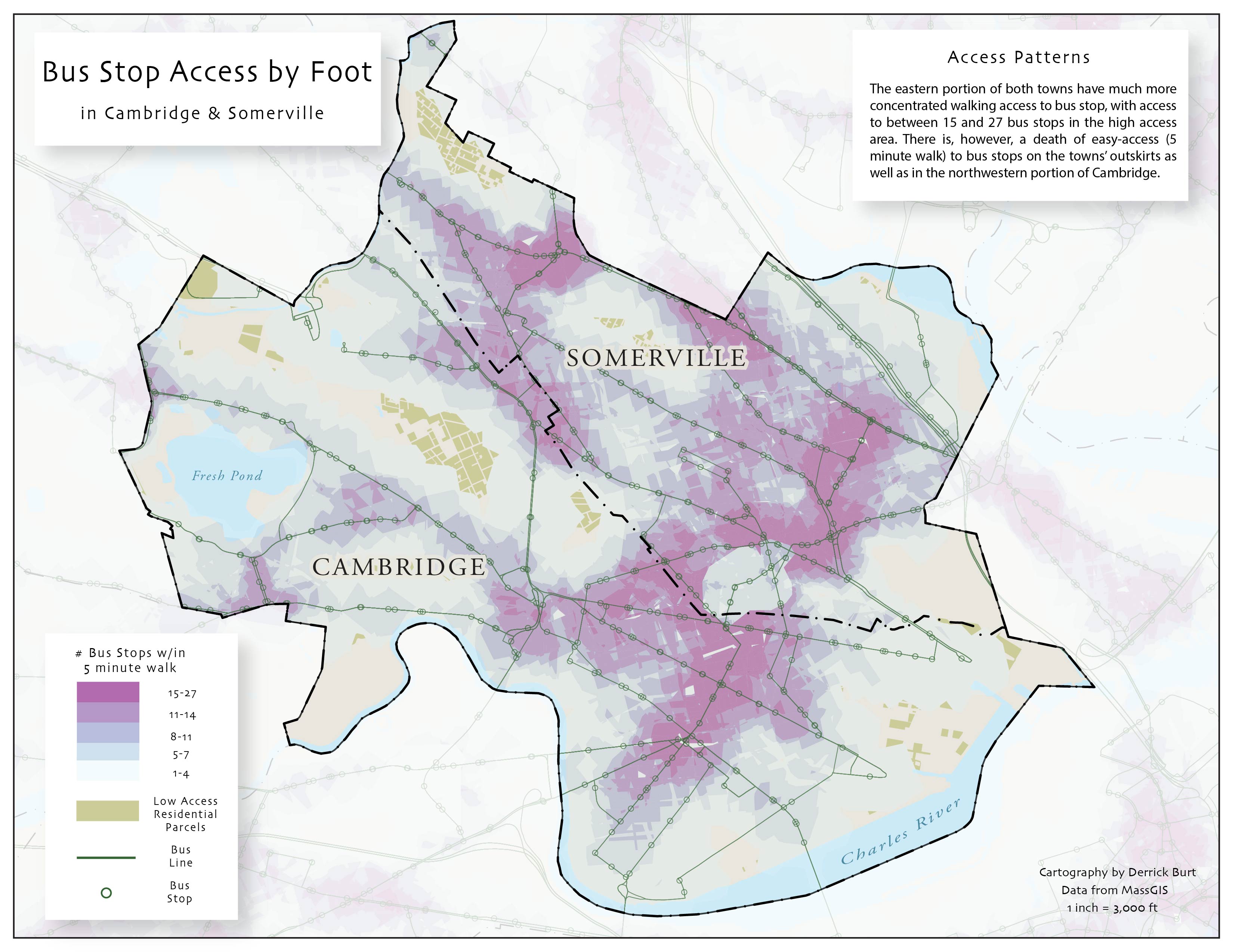
Public Transit Access in Cambridge and Somerville, MA
Purpose
These maps aim to identify the accessibility of bus stops by foot in Cambridge and Somerville in relation to the towns’ land use patterns.
Software
Data
Maps