Derrick Burt's GIS Portfolio
A collection of GIS analyses and maps.
Watershed Conservation in Midcoast Maine
Purpose
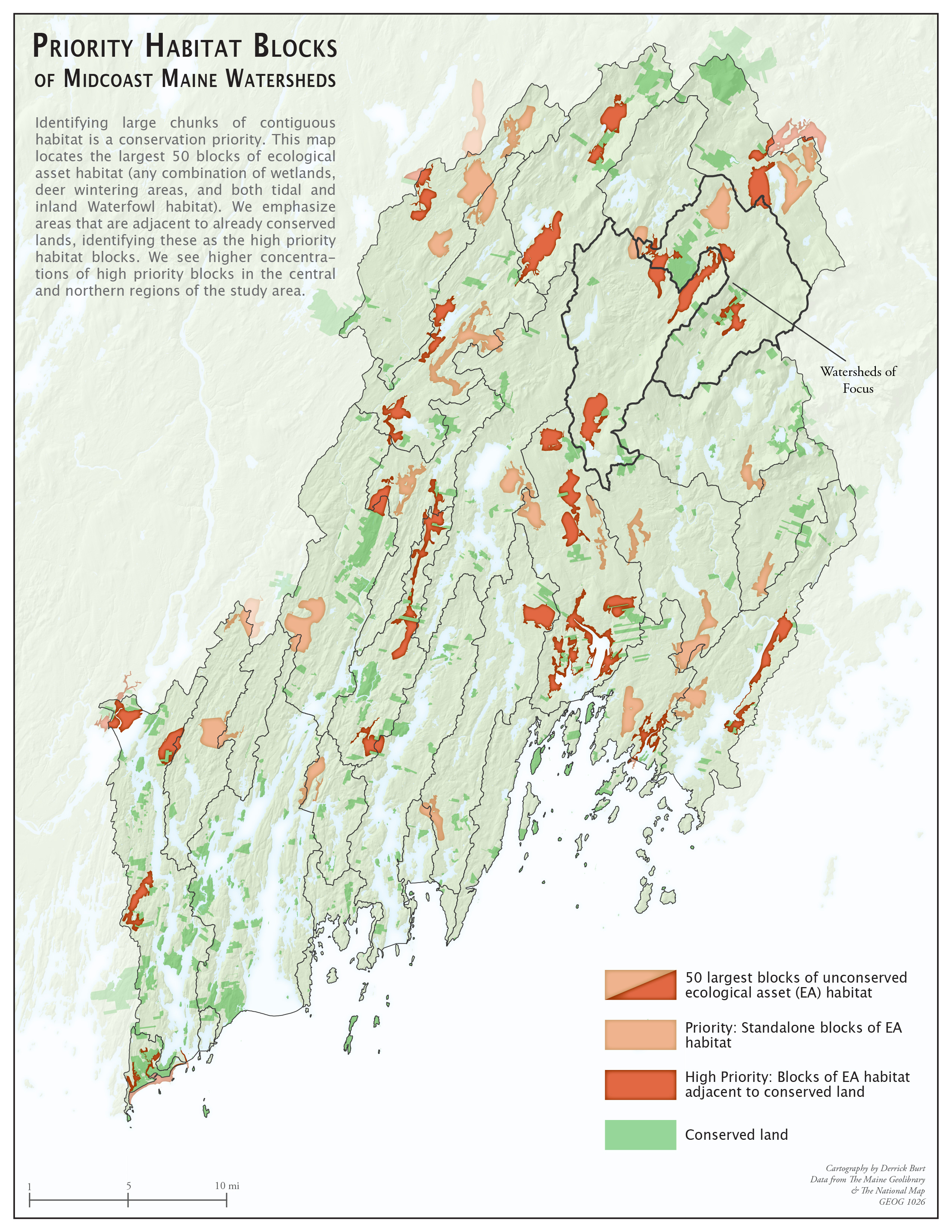
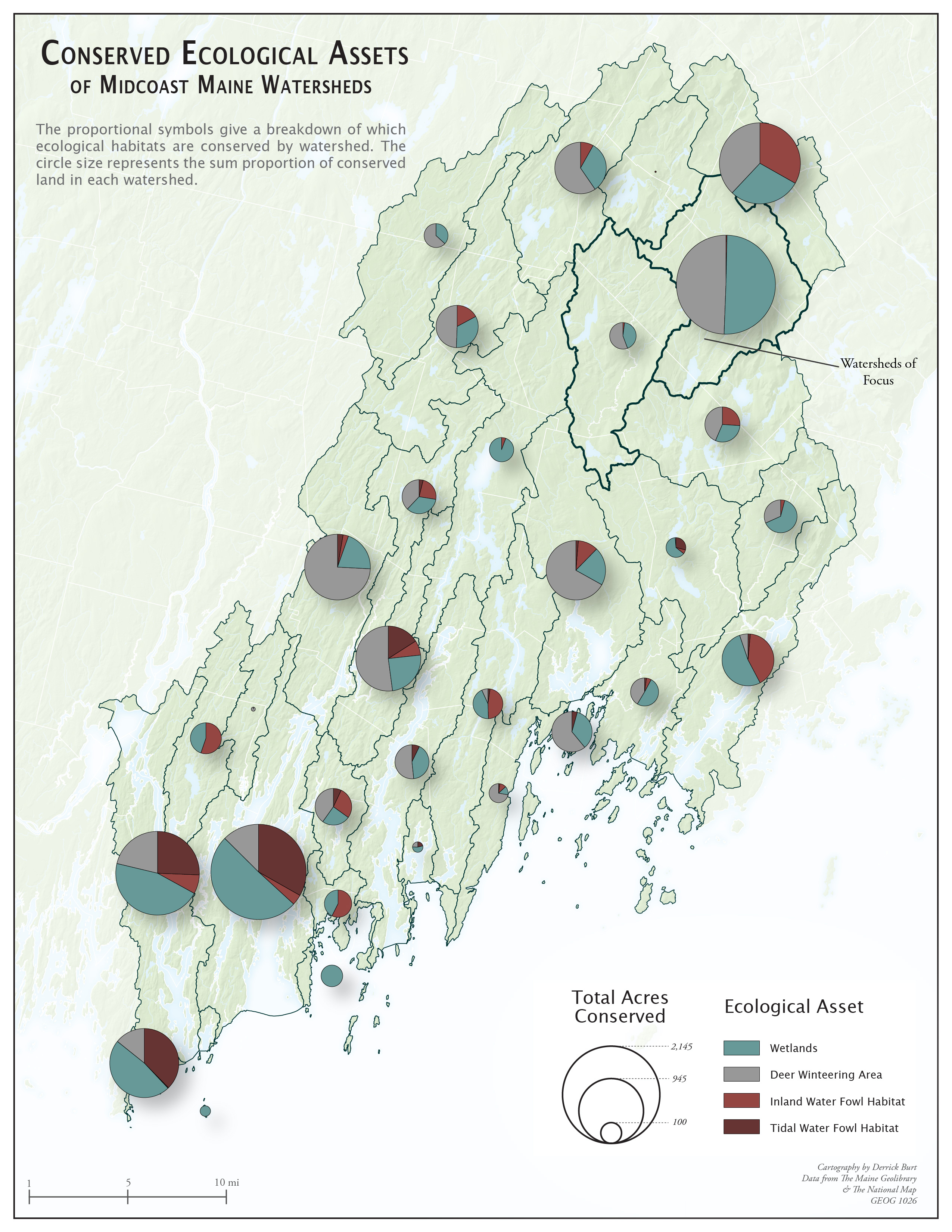
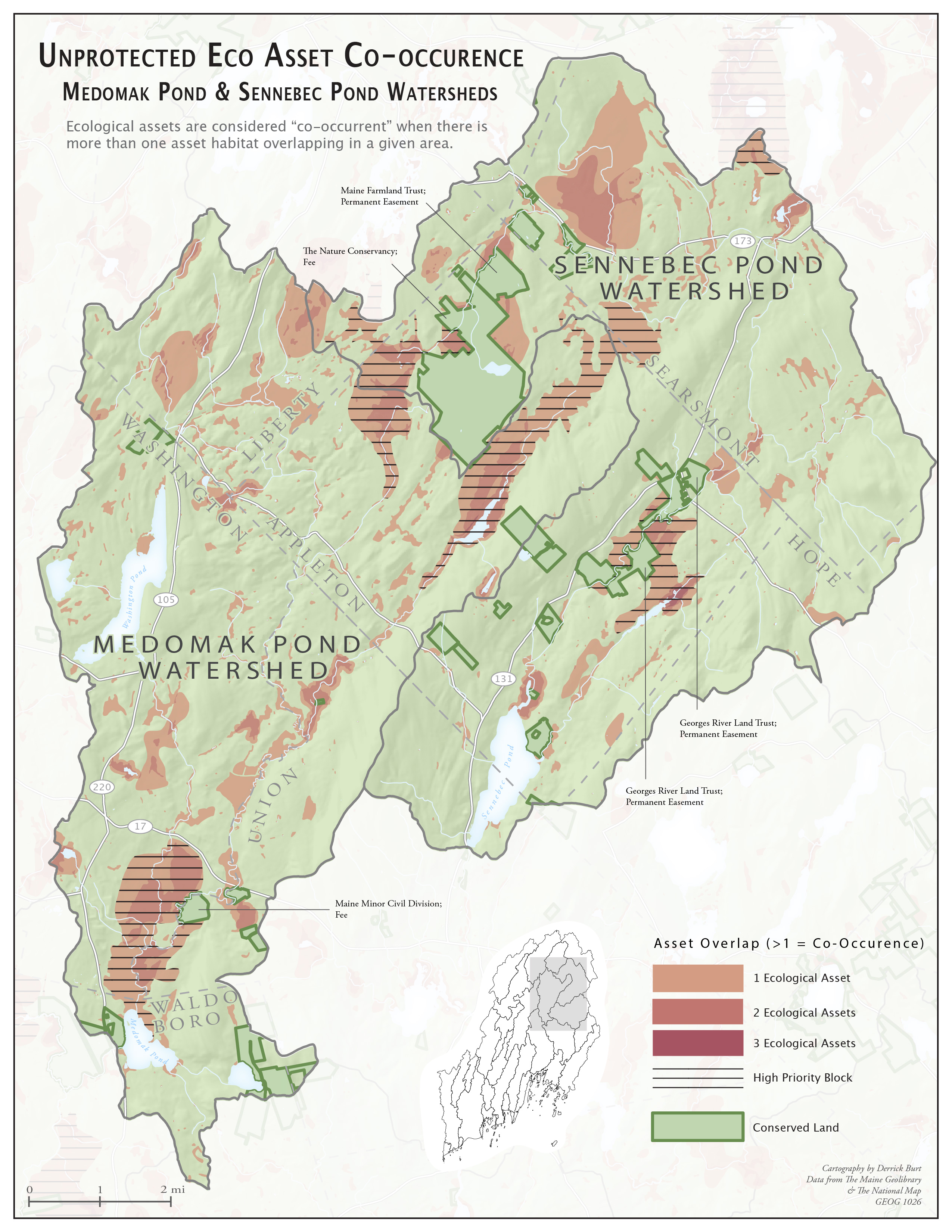
This set of maps aims to define and locate high priority habitat blocks that are not conserved in Coastal Maine.
Software
Data
JPGS
Maps