Derrick Burt's GIS Portfolio
A collection of GIS analyses and maps.
Solar Site Suitability/Development Potential in Chittenden County, VT
Analyzing solar suitability in Chittenden County and reccomending most-suitable parcels.
 |
 |
Watershed Conservation in Midcoast Maine
Defining and identifying high priority habitat blocks that are not conserved in Coastal Maine.
 |
 |
 |
Demographics and Policing Patterns in Boston, MA
Analyzing residential demographics, arrests, and private police contracting in Boston, MA.
 |
 |
 |
Public Transit Access in Cambridge and Somerville, MA
Assesing the accessibility of bus stops by foot in Cambridge and Somerville, MA.
 |
 |
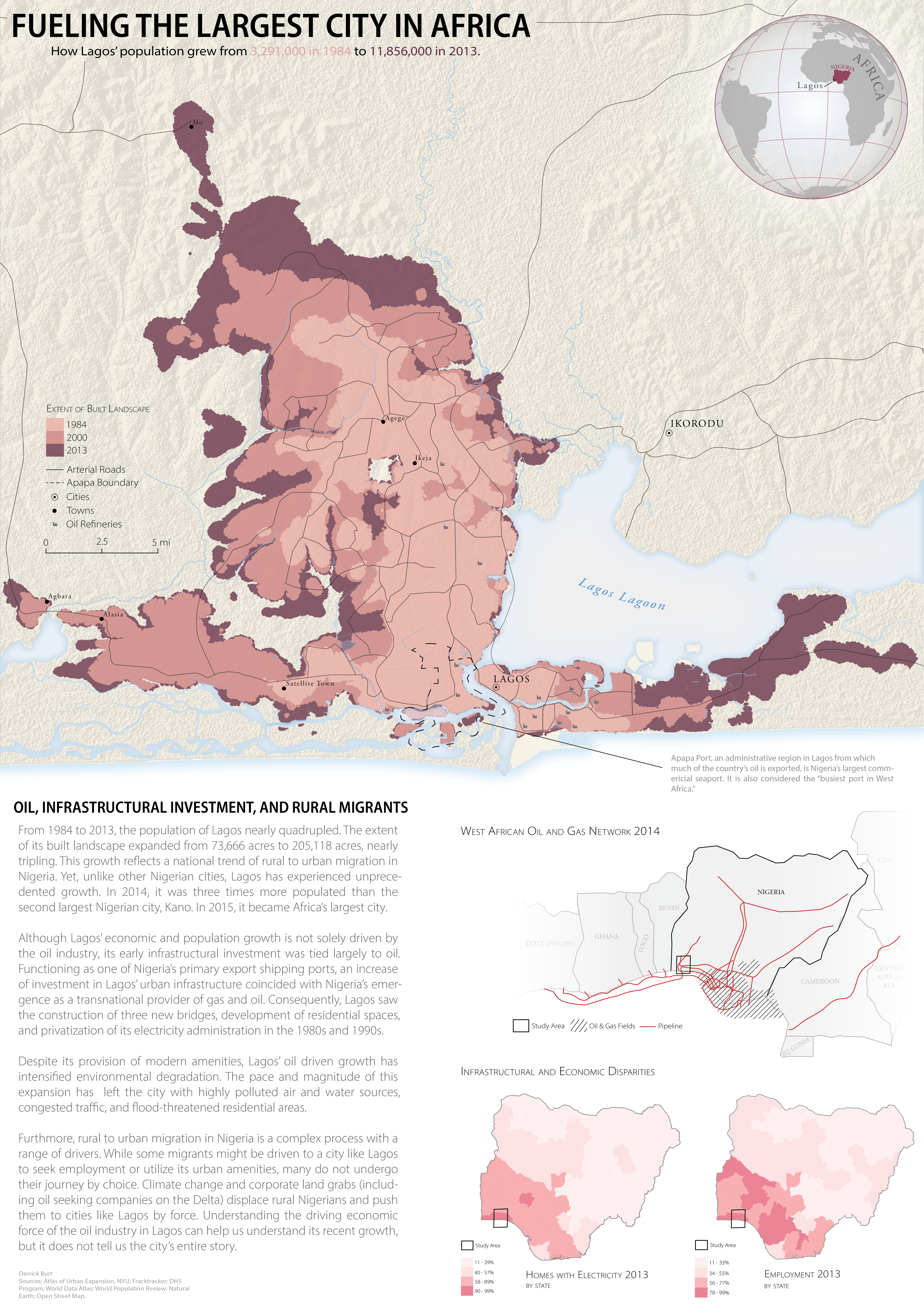
Visualizing Urban Growth in Lagos, Nigeria
Vizualizing Lagos’ growth from 1984 to 2013 and its drivers.
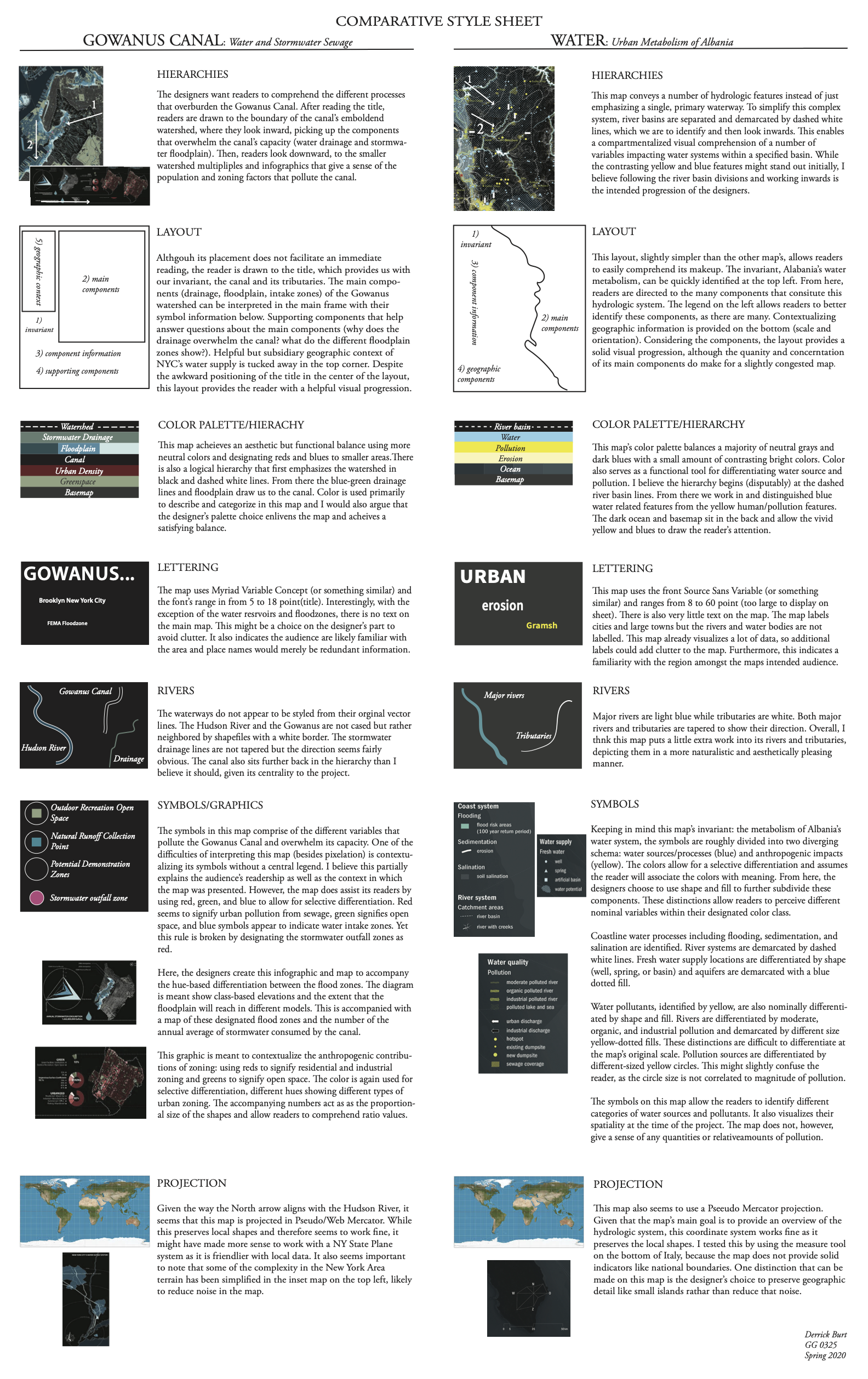
Urban Planning: Design Critique
This exercise compares important design choices between two urban planning maps.